Regulation
The Part 107 knowledge test now includes questions built from live sectional charts
Since October 26 the FAA's remote pilot test can show images from current sectional charts that are not in the testing supplement, so memorizing the supplement is no longer enough.
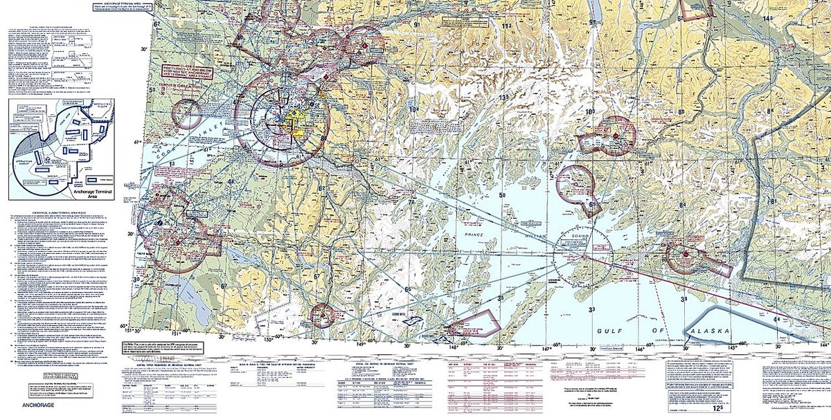

The FAA has changed how it tests chart reading for new drone pilots. Its August 2026 Airman Testing Community Advisory says that starting October 26, 2026, the Unmanned Aircraft General-Small knowledge test (the Part 107 exam) and the Instrument Rating Airplane test include image-based questions that do not come from the testing supplements.
What changes on test day
The new images are taken from current FAA Sectional Charts, Instrument Approach Charts and Low Altitude Enroute Charts. Until now, Part 107 chart questions referred to figures in a fixed supplement that candidates could study in advance. The advisory notes that some questions may require measuring tools and that applicants will be given what they need at the test center. The FAA followed up in a September special edition of the advisory.
The test is popular: DroneXL reports, citing the FAA's 2025 test statistics, that 73,914 Part 107 knowledge tests were taken that year with a pass rate of about 83%.
How to prepare
The practical advice is simple: practice on real charts. Current sectional charts can be downloaded free from the FAA. Candidates should be comfortable finding airspace classes and their altitudes, airport information, obstacles and special-use airspace on an unfamiliar chart, and measuring distances with a plotter.
For companies that hire new pilots, it is worth building chart reading into training rather than relying on test-prep question banks. The skill is the same one pilots use every day when they check whether a job site sits under controlled airspace.
Why it matters
New remote pilots, including new hires at mapping and survey firms, now need to read real, current sectional charts rather than memorize the figures in the testing supplement.
Sources and original reporting
Written by the DroneFlow.Ai News Desk from the sources above. Spotted an error? Tell us and we will correct it.
More drone news
FCC counsel says a ban on foreign thermal, LiDAR and spray drones is still under review
An FCC national security lawyer told a podcast the agency is still reading comments and might allow a transition. Its July notice already proposes 180 days.

FCC exempts Switzerland's Voliro T inspection drone from its Covered List
A conditional approval from the Department of War clears the contact-inspection drone. It is the 21st entry on the FCC's drone approvals list, and it depends on a plan to move production onshore.

FCC votes 3-0 to open the 800 MHz cellular band to drones, ending a 1991 airborne ban
Drones can use about 50 MHz of low-band cellular spectrum once the order takes effect. It does not make flying beyond visual line of sight any easier: that still waits on the FAA.
Fly it, then map it
Upload your drone photos and get maps, 3D models and measurements — free trial, no credit card.