◆ Case Study · Raw-photo reconstruction
547 raw drone photos in.
A full map set out.
No desktop photogrammetry software. We uploaded the raw geotagged frames straight off a DJI RTK aircraft, and DroneFlow.Ai reconstructed the orthomosaic, elevation models, contours, point cloud, and 3D model — start to finish, in 45 minutes.
◆ The orthomosaic DroneFlow built from the raw frames
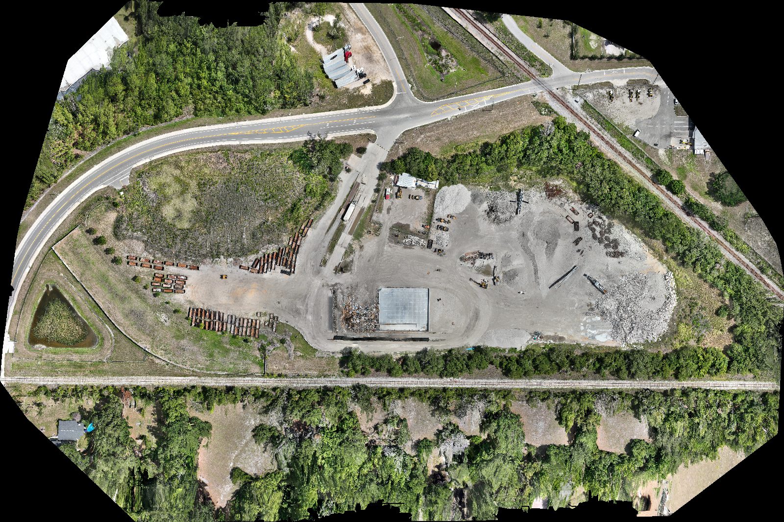
A ~50-acre materials-handling site: highway frontage, twin rail lines, aggregate stockpiles, stacked culvert stock, active equipment, and a retention pond — all stitched from the uploaded photos at 5 cm/pixel. This is the actual output, downsampled only for the web.
What was flown
| Aircraft / camera | DJI M4E · 20.9 MP (5280×3956) |
| Frames | 547 — 200 nadir + 347 oblique |
| Flight altitude | ~51 m AGL |
| Native GSD | ~1.3 cm/px |
| Positioning | DJI RTK, geotagged in-EXIF |
| Ground control / checkpoints | None on this flight |
What DroneFlow produced
| Orthomosaic | 11,109×7,396 px · 5 cm/px |
| DSM & DTM | 10 cm/px · 44.5 m relief |
| Contours | 7,615 lines · 1 ft interval |
| Point cloud | 8,132,721 pts · LAS 1.4 |
| 3D model | Textured mesh + 10,134 web tiles |
| Coordinate system | WGS84 / UTM 17N (EPSG:32617) |
◆ What we measured — and what we didn't
Every deliverable above was opened and validated by the automated pipeline self-checks before this page was written. We're also plain about the limits of a single RTK flight with no surveyed control — because that honesty is the point of a real case study.
Accuracy depends on the aircraft, camera, altitude, flight geometry, image overlap and quality, RTK/PPK correction, ground control, checkpoints, terrain, vegetation, coordinate system, and processing configuration. Centimeter-level results may be achievable with appropriate RTK, PPK, surveyed ground control, checkpoints, and qualified validation. DroneFlow.Ai outputs do not constitute a licensed land survey unless reviewed and certified by an appropriately licensed professional.